jekyll-map
A Jekyll plugin that provides a map Liquid tag for embedding static map images from Mapbox or Google Maps with no JavaScript required.
jekyll-map is a Jekyll plugin that embeds a static map image anywhere in your Jekyll site with a single tag. It outputs a plain <img> element with no JavaScript. Supports both Mapbox Static Images and Google Static Maps as providers.
Demo
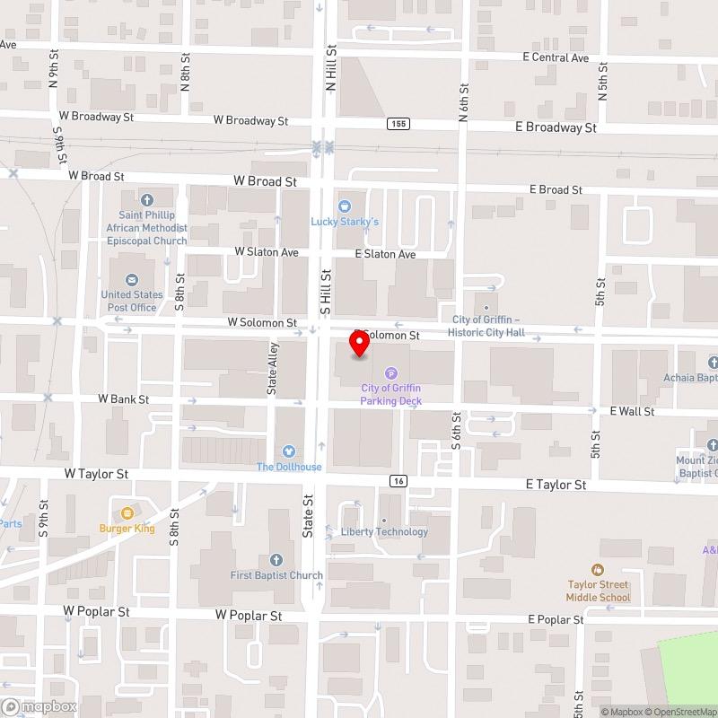
The map below shows 100 S Hill Street in downtown Griffin, Georgia, geocoded at build time from the address string using Mapbox:
{% map "100 S Hill Street, Griffin, GA" zoom=16 width=800 height=800 %}
Switch to Google Static Maps per-tag with provider=google:
{% map "100 S Hill Street, Griffin, GA" provider=google style=hybrid zoom=16 %}
Why This Exists
If you write about places — neighborhoods, projects, events, real estate, local government — you often want a quick map. Existing options either require JavaScript embeds or send your readers to a third-party page. jekyll-map outputs a plain image that works everywhere, loads fast, and needs no client-side code.
Source Code
- GitHub: github.com/jchance/jekyll-map
- RubyGems: rubygems.org/gems/jekyll-map
Installation
Add to your Gemfile:
gem "jekyll-map", "~> 0.2"
Add to _config.yml:
plugins:
  - jekyll-map

map:
  provider: mapbox        # or google
  zoom: 13
  mapbox:
    token: pk.your_public_access_token_here
    style: streets
  google:
    key: AIzaSy...
Then run bundle install.
Usage
By address string (geocoded at build time, cached in _map_cache.json):
{% map "City Hall, Griffin, GA" zoom=15 %}
By latitude and longitude:
{% map lat=33.248329 lng=-84.263336 zoom=16 %}
With style and size options:
{% map lat=33.748 lng=-84.388 style=satellite zoom=16 width=1200 height=500 %}
{% map "Atlanta, GA" marker=false style=light alt="Atlanta metro area" %}
Override provider per tag:
{% map "Griffin, GA" provider=google style=hybrid zoom=14 %}
{% map lat=33.248329 lng=-84.263336 provider=mapbox style=outdoors %}
Supported Parameters
| Parameter | Default | Description |
|---|---|---|
lat |
— | Latitude (required if no address string) |
lng |
— | Longitude (required if no address string) |
zoom |
13 |
Zoom level (0-22) |
width |
800 |
Image width in pixels |
height |
400 |
Image height in pixels |
marker |
true |
Show a marker at the center |
style |
streets |
Map style (see below) |
provider |
config value | Override provider: mapbox or google |
alt |
"Map" |
Alt text for the <img> tag |
Mapbox styles
streets, satellite, outdoors, light, dark
Google map types
roadmap, satellite, terrain, hybrid
Styling
The plugin outputs an <img> with the class jekyll-map:
.jekyll-map {
  width: 100%;
  height: auto;
  border-radius: 4px;
}

jekyll-llms-generator
jekyll-mux